Think Global, Act Local
A strategic framework for a clean ocean
Combating marine pollution by turning every individual into a vital data contributor and every bit of data into a strategic solution
Core Principles
-
You can't manage what you can't measure.
Eyesea pollution data and analysis forms the foundation for understanding and evaluating impact. -
Solutions are identified, designed, and driven together with local communities.
-
Fostering partnerships with local governments, NGOs, businesses, and academic institutions.
-
Aiming for long-term impact beyond project completion.
-
Recognizing unique regional contexts and adjusting approaches accordingly.
Pillar 1: Eyesea Crowd-Sourced Intelligence, the Eyesea App
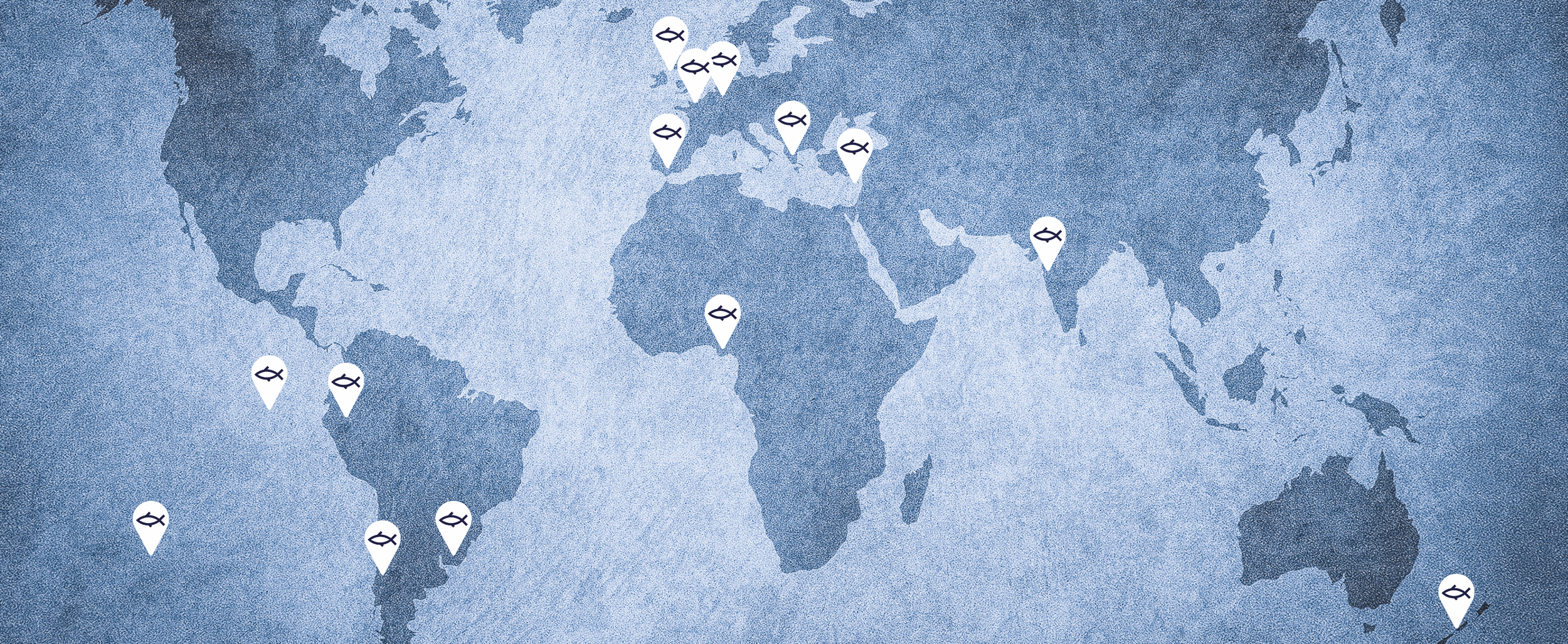
Empowering the Global Community
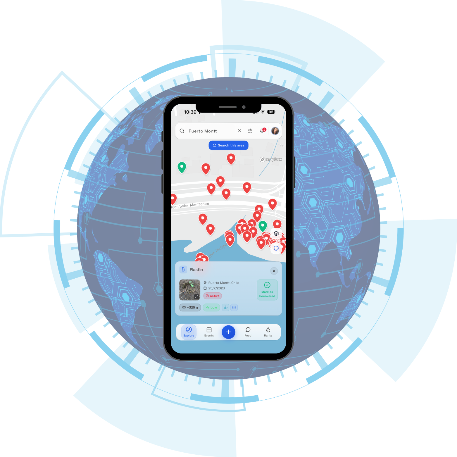
Pollution is everywhere, but we can't be everywhere at once. There are an estimated 7.2 billion photos taken every day worldwide. Imagine the impact if these served a greater purpose. What if we could turn this simple, everyday gesture into a force for global change? By taking a picture of marine pollution and sharing it through the Eyesea app, you anonymously transform a casual photo into a powerful data point.
Our mobile app allows anyone, anywhere, to document pollution with a simple photo, fostering a global network of “eyes of the sea“. This creates a high-volume, real-time map of marine debris that reveals hotspots and trends with unprecedented speed.


Pillar 2: The Eyesea Program
From Insights to Impact, Tech-Powered Solutions at Scale
A systematic, high-impact approach combining cutting-edge technology with on-the-ground expertise to drive lasting change.
-
Advanced satellite spectrometry and AI-driven analysis to identify pollution hotspots and quantify volume.
-
Field teams visit locations to validate data and provide firsthand insights into local conditions.
-
Compile findings into comprehensive reports to engage stakeholders and build solution coalitions.
-
Work with communities and partners to design tailored solutions from cleanup projects to policy recommendations.

Pillar 3: Eyesea Insights
Leveraging expertise and data for sustainable impact
We create comprehensive, data-rich reports to governments, businesses, and organizations interested in monitoring and understanding pollution in specific areas.
Using advanced satellite spectrometry, in-depth data analysis capabilities and human expertise, we deliver insights into coastal water pollution through a comprehensive and highly detailed map and report on the environmental status of a specified coastal area. This allows us to deliver cost-efficient, actionable reports that inform policy, optimize clean-up logistics, and guide investment in ocean health.
Featured Programs
-
![]()
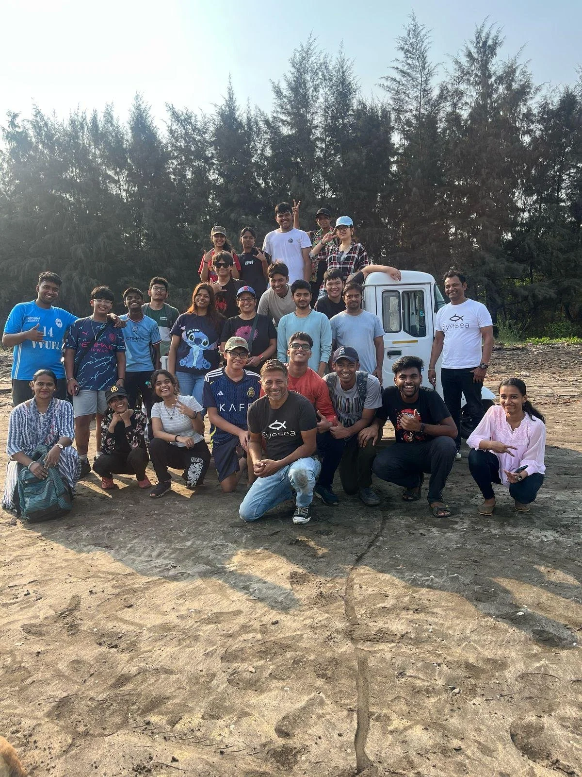
Eyesea India
One of the strongest Eyesea communities with impressive commitment and results. A great example of the Eyesea Program, where it all started with measuring, collecting data and cleaning up coastal areas. We soon realized we needed a sustainable solution and set up a recycling facility that allows us to collect and process tons of waste. This generates a triple impact: environmental, economic and social.
-
![]()
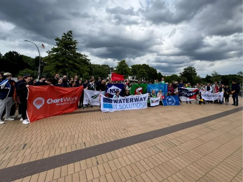
Eyesea Germany
From the beginning, Eyesea has relied on good people —and thanks to the incredible support from the shipping community, we’re seeing that vision come to life in a powerful way. Over 100 volunteers come together to support this effort, with contributions from across the industry with more than 25 shipping companies coming together to protect our oceans and coasts.
-
![]()
Eyesea in Patagonia
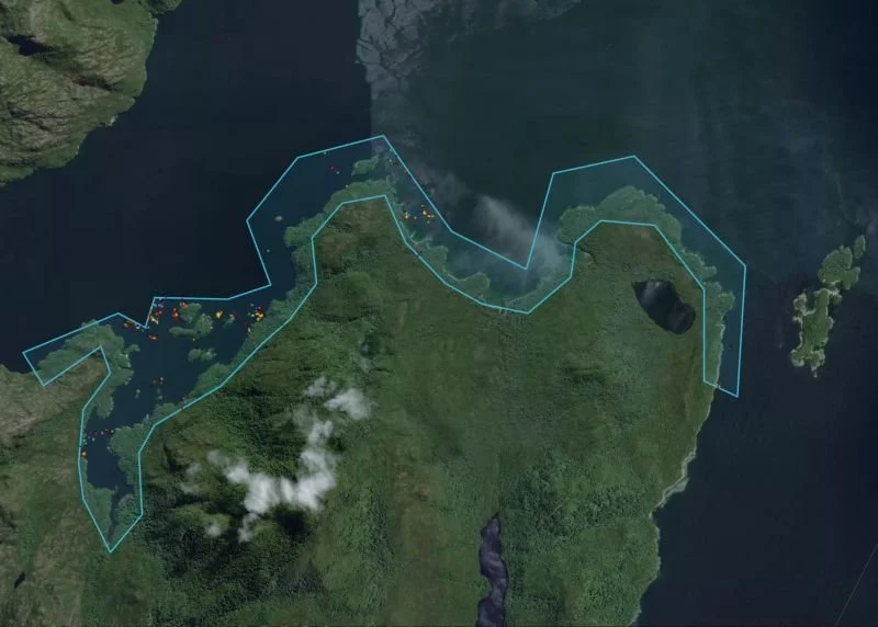
Eyesea, in partnership with Paz Recycling, run a pilot program to monitor and manage coastal waste in Patagonia using satellite image spectometry from the Eyesea member Grundo . The initiative, launched as part of SalmonChile AG’s open innovation challenge, Observatorio de Playas, aims to enhance coastal surveillance and optimize cleanup operations.
-
![]()
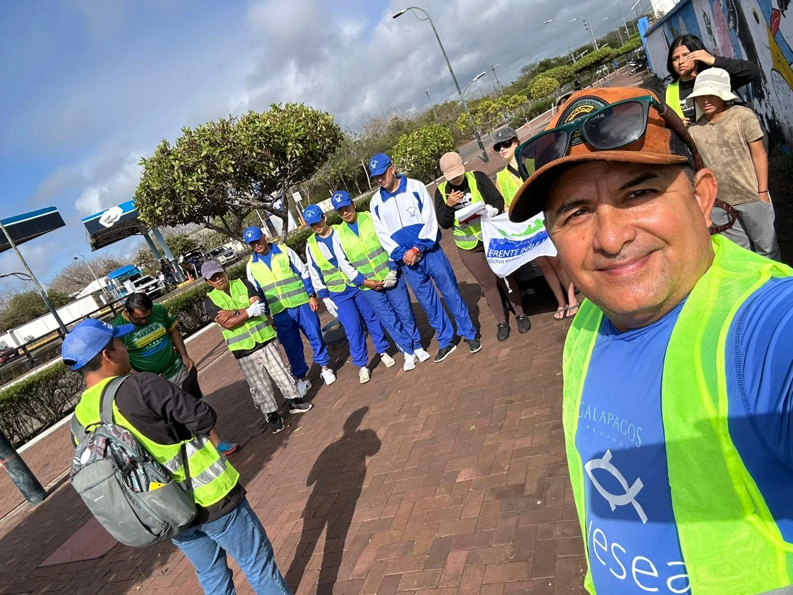
Eyesea Galápagos Islands
Eyesea has built an incredible community in this UNESCO Biosphere Reserve that not only drives continuous action cleaning up tons of waste, but is also a referent when it comes to environmental awareness. Hundreds of awareness and institutional sessions that take us one step closer to improving the health of our oceans for future generations.
-
![]()
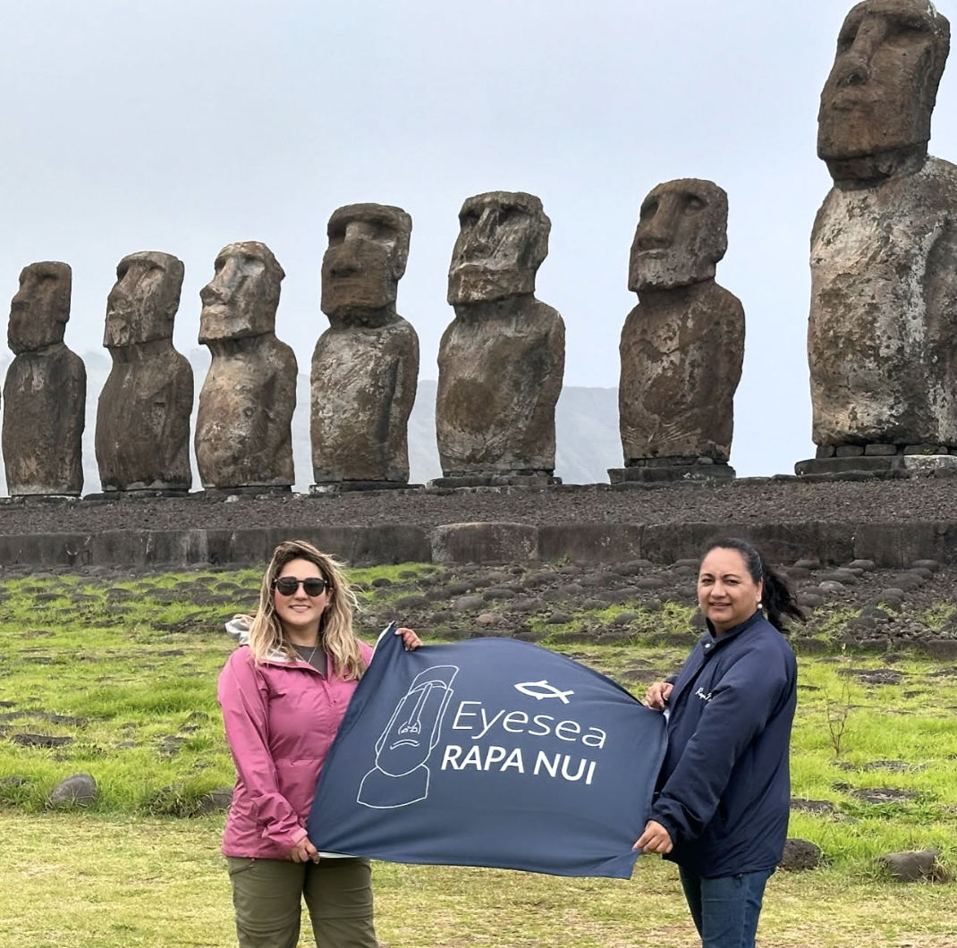
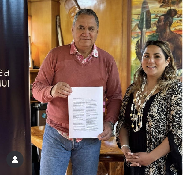
Eyesea Rapa Nui
Eyesea supports the conservation of Easter Island, a magical UNESCO World Heritage Site, through multiple programs. With a strong and committed community, together we drive cleanups, awareness and government and local collaboration to protect these magical coastal areas.
-
![]()
Eyesea Chile
In collaboration with Paz Recycling and Basura Playera, our strong community in Chile not only recovers and recycles hundreds of tons of waste every month, but also work closely with government institutions, organizations and schools to drive lasting change.
-
![]()
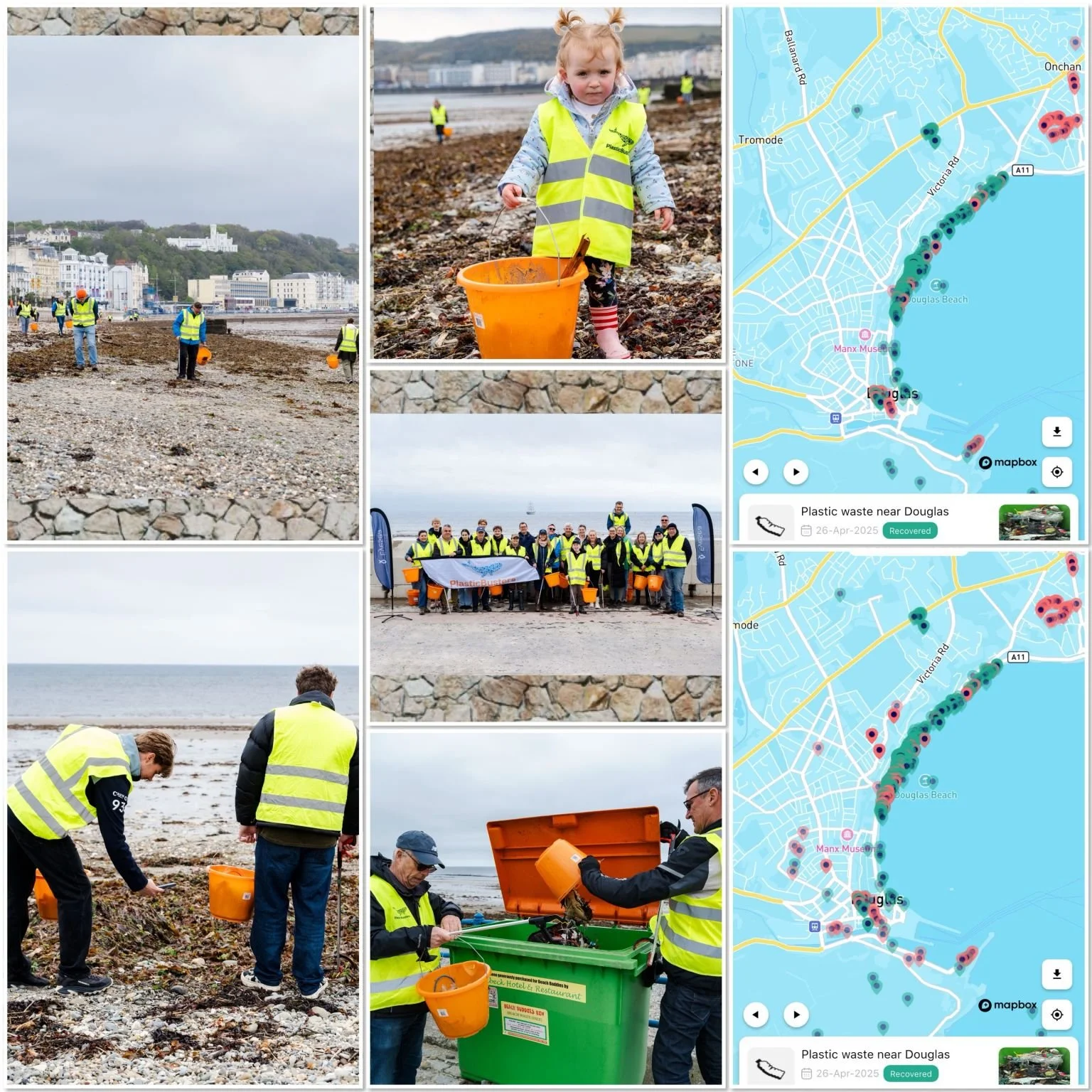
Eyesea Isle of Man
We supports this beautiful UNESCO Biosphere since Eyesea was created. With a strong community engagement, we are proud to see organizations and individuals relentlessly coming together to map and recover coastal pollution.

-

Join our global community and be part of the solution
-

Lead and inspire others in ocean conservation
-

Support our mission through a membership contribution
-

Collaborate with us to scale ocean protection